
River rise ...
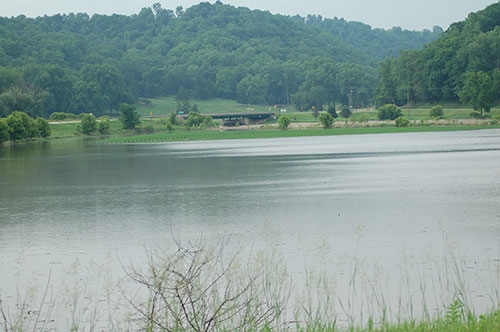
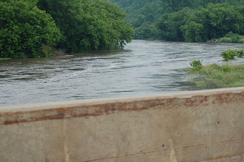
The Upper Iowa River was on the rise over the weekend as heavy rains dumped reported totals of anywhere from two to five inches of rain throughout Allamakee County Saturday, June 9. Those rainfall amounts fell in less than a five-hour period in most cases and followed a slightly less significant rainfall of an inch or so that passed through Allamakee County Friday morning, June 8. The end result of those rain events raised the Upper Iowa River more than double its original depth at its measuring station on the Highway 76 bridge near Dorchester in less than 48 hours, including a spike from its usual depth of around eight feet Saturday afternoon, June 9 past its minor flood state of 14 feet to more than 15.5 feet less than 12 hours later as those heavy rains poured down. Although no additional rainfall fell Sunday, June 10, those rainwaters from the previous day continued to drain into the Upper Iowa River basin throughout the day Sunday, ultimately pushing the Upper Iowa River to its crest at 17.29 feet early Monday morning, June 11 around 3:30 a.m., according to the National Weather Service. That crest was just over the river’s moderate flood stage of 17 feet, where the river spills heavily over into adjacent farm fields and property areas, but nowhere near the record flooding level of 24.3 feet recorded in August of 2016. The photos above were taken around 7:30 a.m. Monday, June 11, as the flood waters began to recede but obviously still impacted adjacent farm fields (as pictured in the top photo where the Highway 76 bridge and measuring station is located in the background) and still filled its banks well (as pictured in the bottom photo as seen from the Highway 76 bridge deck). Those flood waters continued to recede throughout Monday, doing so rather quickly to return below the minor flood stage of 14 feet approximately 12 hours after reaching its crest.