
Crest at Harpers Ferry ranks fourth as well ...
Although nestled in between the two National Weather Service river level gauges between Lansing and McGregor on the Iowa side of the Mississippi River, there was still plenty of evidence of the river’s flooding water levels around the Harpers Ferry community this past week. A river gauge at the Allamakee County Conservation Boat landing at Harpers Ferry further confirms the height of the river at its crest Friday, April 28, as well as its ranking among the top four crests all-time (behind the 1965 record and two more recent recordings in 2001 and 1997 shown on the gauge).
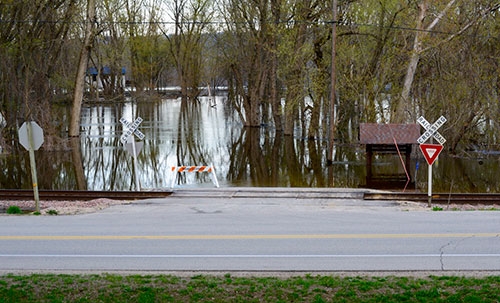
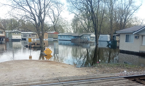
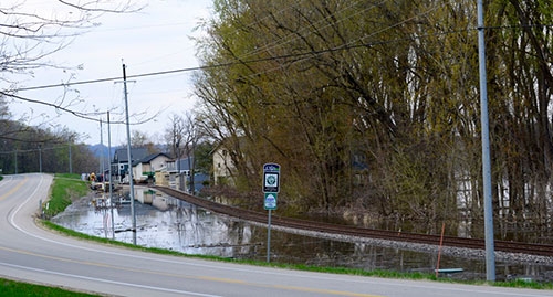
With the history and unpredictability of the Mighty Mississippi in mind, most residences within the riverside communities near Harpers Ferry along the Great River Road/County Road X52 have been built high enough or protected well enough to avoid much, if any, interior damage from this spring’s high water. Accessing those residences, however, certainly faced its own challenges, as evident in the photos above that show the high river levels in Hartman’s Riverside Court and the closed access to Nobles Island south of Harpers Ferry (photo above). The photo below looking north along the Great River Road from its intersection with Paint Rock Road south of Harpers Ferry shows just how close the river waters at their Friday crest were to breaching both the highway and the railroad tracks.
Since reaching its crest Friday along its Allamakee County border, the Mississippi has been slowly but consistently receding, already falling below its moderate flood stage of 19 feet at Lansing Sunday, April 30 but not forecasted by the National Weather Service to do so at McGregor until the middle of this coming weekend. By that time this coming weekend, the National Weather Service has that Lansing gauge forecasted to fall beneath its minor flood stage of 17 feet. Photos by Scott Boylen Photography.